Tags
Buena Onda, Casa Rosada, Hacienda Iguana, Hostal Las Tortugas, Limon 1, Limon 2, Nica Waves, Nicaragua, Nicaragua Map, Nicaragua Rental, Rancho Santana, Zeebra Maps
Needing privacy and isolation to work on a deadline last year, I stayed at Casa Rosada, part of the Rancho Santana Project along Nicaragua’s southern Pacific Coast. Mike, the owner of Casa Rosada, suggested that I draw a Zeebra Map for the area, which presented several unexpected problems. While I slowly explored the 4-wheel drive backroads, the sleepy area from Hacienda Iguana to La Salinas fast endeared itself to my senses!
Quickly discovering there were no decent maps of the area, (most showed the entire area as “POPOYO”) I slowly plotted the curves of the roads and noted points of interest while a friend navigated the bumpy and often-muddy roads. The map incubated as we explored side roads, stopped for sodas or inquired about locations. The locals gladly nudged us along, though finding correct names of beaches and where one community started while another ended was one big question mark!
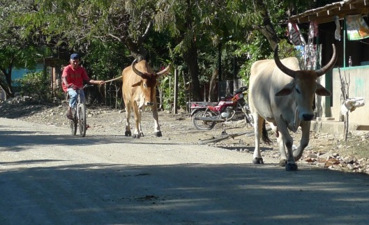
 Certain icons kept appearing: stout pigs with clever fence-proof yokes roamed the roadsides, cattle and oxen pulled wooden carts at a snail’s pace, and sleek horses grazed in pastures, still green from the rainy season.
 The cram-packed buses needed no embellishments or exaggerations! Bus watching is a unique pastime and is guaranteed to bring a few chuckles to one’s day!
Spend time in this sleepy little area, and you’ll soon acclimate to a slower lifestyle.

Ojo de Agua Caliente - La Salinas
Basic necessities are available in the small tiendas, so a rugged trip to Rivas is often necessary. Map research took me to Rivas, and a police officer (on vacation!) proudly escorted me through the major hub-town; friendly Luis helped me find a new supply of technical drawing pens, but we struck out on maps! The municipality maps were not in Rivas, but back in the community of Tola.
In the municipality offices of Tola, various large antique maps showed most of the beaches and pueblitos of that area. Jackpot! I could finally move forward with the the map!
The locals seemed pleased and proud to have the new map drawn of their area. I arrived as a stranger but left as part of their extended family!
 The owners of the LIMON DOS MINI MARKET not only tirelessly drove me from area to area, but also shared papayas, colas, and their genuine friendship. Many afternoons found me lingering there as we watched the afternoon shadows slice
 the landscape while chickens pecked at random kernels of corn. At times nearby guests and residents of Rancho Santana galloped by on horseback. Sometimes less is more; yes, less is much more in this unique community!
If you find yourself traveling through the area, please thank the sponsors for helping this map evolve!
Z
SPONSORS:


Pingback: NICARAGUA « playamart
Pingback: Ecuador « playamart
Pingback: Green, Green & More Green! « Zeebra Designs & Destinations